Kunar
Information Kunar
Kunar is one of the 34 provinces of Afghanistan, located in the northeastern part of the country. Its capital is Asadabad. Its population is estimated to be 508,224.
Kunar has major political groups include Wahhabis or Ahl-e- Hadith, Nazhat-e Hambastagi Milli, Hezb-e Afghanistan Naween, Hezb-e Islami Gulbuddin etc.
Kunar, along with Nuristan, was part of the borderlands known as Kafiristan, and until a few decades ago, it was never considered a true part of Afghanistan.
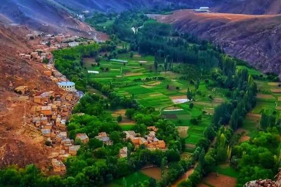
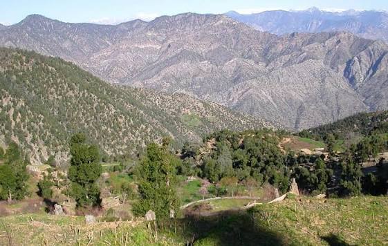
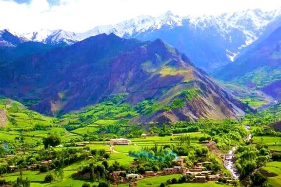
Kunar is a sparsely populated, mountainous, forested border area.
Kunar is a Nuristani word, according to the book “Ancient and Modern Kunar”, which means the olive valley.
Kunar was formerly under the rule of Nangarhar Province, but has become an independent province since 1965. Most of the inhabitants of this province are Pashtuns.
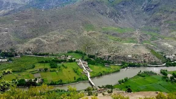
Kunar is one of the mountainous and forested provinces of Afghanistan, covering an area of about 4,300 square kilometers and located in eastern Afghanistan.
The province borders Nuristan Province to the north, Nangarhar Province to the south, Laghman Province to the west, and Pakistan to the east.
Get in
Step-by-Step Directions:
1. Start from Kabul
• Take the Kabul-Jalalabad Highway (NH08) heading east.
• This part passes through the Lataband Pass and descends into Nangarhar Province.
2. Reach Jalalabad (Nangarhar capital):
• You’ll pass through Surobi and along the Kabul River.
• Distance: ~150 km (2.5 to 3.5 hours)
3. From Jalalabad to Asadabad (Kunar capital):
• Take the road northeast along the Kunar River toward Asmar-Asadabad.
• The road is partially paved but can be narrow in parts.
• Distance: ~90-100 km (1.5 to 2 hours).
Districts of Kunar Province
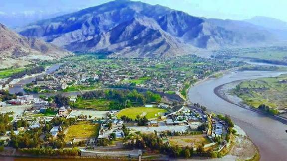
Asadabad or Asadabad is a small city and the capital of Kunar Province. Some people also say that Jamaluddin Asadabadi was born in this village. Kunar Province has 15 districts, which are:
1- Asadabad:
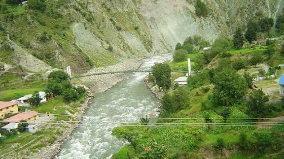
Asadabad city is the capital of Kunar province, which has an area of 480 square kilometers and has a very beautiful nature. In particular, the existence of the Pich Valley has added to the beauty of this city.
Asadabad is also known as Choghan Sarai, and there is a historical hill called Choghan in the north of Asadabad city, which has survived the rule of the Choghanis and has historical value.
2- Narang District:
This district is located south of Asadabad city along the Asadabad-Jalalabad highway and has an area of about 164 square kilometers. Most of the population of this district are farmers or livestock keepers.
3- Choki District:
This district, which consists of mountainous and forested areas, is located south of Asadabad and along the Jalalabad highway, and has an area of about 249 square kilometers.
4- Nur Gul District:
This district is also located south of Asadabad city along the Jalalabad highway. With an area of 367 square kilometers, it borders Dara Noor District of Nangarhar.
5- Kunar Special District:
This district is located southeast of Asadabad and has an area of 337 square kilometers.
6- Sarkanu District:This district is also located southeast of Asadabad and its area is 297 square kilometers.
7- Marawara District:
This district is located east of Asadabad and has an area of about 159 square kilometers. In addition to being neighboring the provincial capital of Kunar, this district also neighbors the Sarkanu and Shigal districts.
8- Shigal:
This district is located east of Asadabad and consists of forested areas.
9- Asmar District:
This district is located east of Asadabad and has an area of about 910 square kilometers.
10- Dangam District:
Dangam District is a mountainous district with an area of about 334 square kilometers, most of its residents are livestock and farmers.
11- Ghaziabad District:
This district is located east of Asadabad city and has an area of about 377 square kilometers. Gujar, Salarzai and Mashwani tribes live in this district and lush forests can be seen in the mountainous areas of this district.
12- Nari District:
This district is also located east of Asadabad city and has an area of about 377 square kilometers. The mountains of this district are covered with Najo trees. Nari District is neighboring Kamdish District in eastern Nuristan and Ghaziabad District.
The residents of this province are Gujar, Salarzai and Mashwani tribes.
14- Manogi District of:
this district is also located in the north of Asadabad city and is considered the largest district of this province in terms of population and area. The area of this mountainous district is 531 square kilometers.
One of the important points in this province is the existence of mines and precious stones, which has caused the people of this district to be engaged in mining in addition to agriculture and livestock.
15- Chapa Dara District:
This district is also located north of Asadabad, the capital of Kunar province, and has an area of 229 square kilometers. This district is neighboring with Wama (the central district of Nuristan) and Laghman province.
Most of the residents of this province are from the Safi tribe. This district, like Manogi district, also has mines and precious stones.