Badakhshan
Information Badakhshan
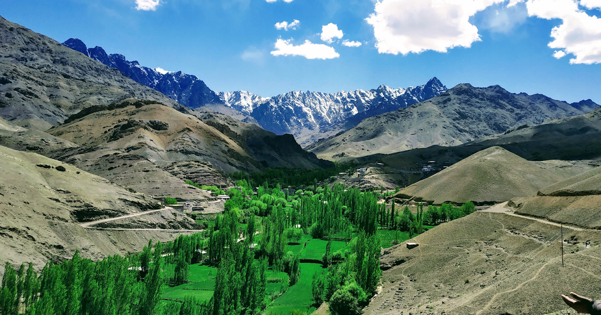
Badakhshan is one of the 34 provinces of Afghanistan, located in the northeastern part of the country. It is bordered by Tajikistan's Gorno-Badakhshan in the north and the Pakistani regions of Lower and Upper Chitral, as well as Gilgit-Baltistan in the southeast. The province shelters Noshaq, the highest mountain in Afghanistan, and has Afghanistan's only border with China spanning 91 kilometers (57 miles) in the eastern side of the province via its Wakhan District.
It is part of a broader historical Badakhshan region, parts of which now also lie in Tajikistan and China. The province contains 22 districts, over 1,200 villages and approximately 1,055,000 people. Fayzabad serves as the provincial capital.
More to know: Despite massive mineral reserves, Badakhshan is one of the most destitute areas in the world. Opium poppy growing is the only real source of income in the province and Badakhshan has one of the highest rates of maternal mortality in the world, due to the complete lack of health infrastructure, inaccessible locations, and bitter winters of the province.
Lapis lazuli has been mined in the Sar-e-Sang mines, located in the Kuran wa Munjan District of Badakhshan, for over 6,000 years. The mines were the largest and most well-known source in ancient times. Most recent mining activity has focused on lapis lazuli, with the proceeds from the lapis mines being used to fund Northern Alliance troops, and before that, anti-Soviet Mujahideen fighters. Recent geological surveys have indicated the location of other gemstone deposits, in particular rubies and emeralds. It is estimated that the mines at Kuran wa Munjan District hold up to 1,290 tonnes of azure (lapis lazuli). Exploitation of this mineral wealth could be key to the region's prosperity.
On 5 October 2018 in Washington, D.C., Afghan officials signed a 30-year contract involving a $22 million investment by investment group Centar and its operating company, Afghan Gold and Minerals Co., to explore and develop an area of Badakhshan for gold mining.
Get in
To reach Badakhshan, Afghanistan, the most common route is via air travel to Kabul and then a connecting flight or road trip to Fayzabad, the provincial capital.
Alternatively, you can enter Badakhshan via the Wakhan Corridor from Tajikistan, but this is a more complex and expensive option.
By plane
Connecting Flight:
Several airlines like Kam Air and Ariana Afghan Airlines offer flights from Kabul to Mazar-e-Sharif, which is closer to Badakhshan than Kabul. From Mazar-e-Sharif, you can potentially arrange local transport to Badakhshan, though this may involve a long road trip.
Driving: It is also possible to drive from Kabul to Faizabad, which takes approximately 8 hours and 51 minutes.
See
• Faizabad district
• Kishm district
• Jurm district
• Kuran wa munjan district
• Zebak district
• Ishkashim district
• Wakhan district
• Baharak district
• Shighnan district
• Ragh district
• Khwahan district
• Darwaz district
• Shahri buzurg
Best Places to visit in Faizabad district:
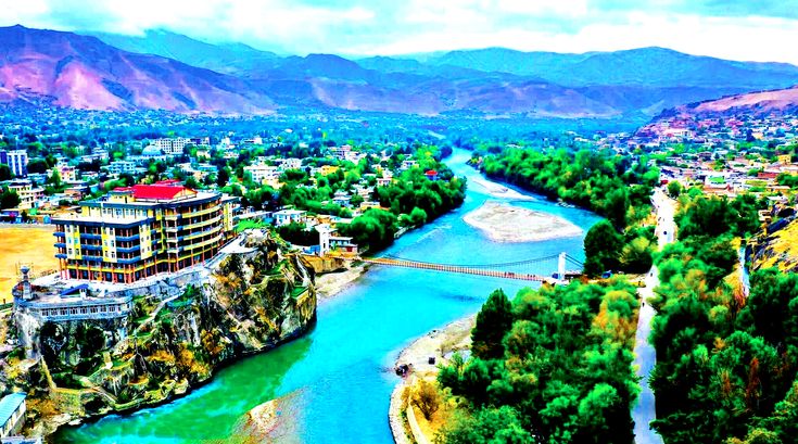
1. Faizabad district:
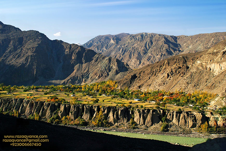
Faizabad also known as Feyzabad or Faizabad, is a city in northeastern Afghanistan, with a population of around 39,555 people. It is the provincial capital and largest city of Badakhshan province.
It is situated in Fayzabad district and is at an altitude of 1,254 m (4,114 ft).
Fayzabad is the main commercial and administrative center of the Pamir region. The Kokcha River runs alongside the city.
Pamir region:
The Pamir Mountains are a range of mountains between Central Asia and South Asia.
They are located at a junction with other notable mountains, namely the Tian Shan, Karakoram, Kunlun, Hindu Kush and the Himalaya Mountain ranges. They are among the world's highest mountains
2. Kishim district:
Kishim District is one of the 29 districts of Badakhshan province in eastern Afghanistan.The district capital is Mashhad. The district is located in the Keshem Valley, a primarily rural area on the western edge of the province, and is home to approximately 89,833 residents, making it the second most populous district of the province.
Climate
Kishim has a humid continental climate, with warm summers and cold winters. The temperature in July averages 21.6 °C (70.9 °F). January has the lowest average temperature of the year. It is −3.8 °C (25.2 °F).
3. Jurm district:
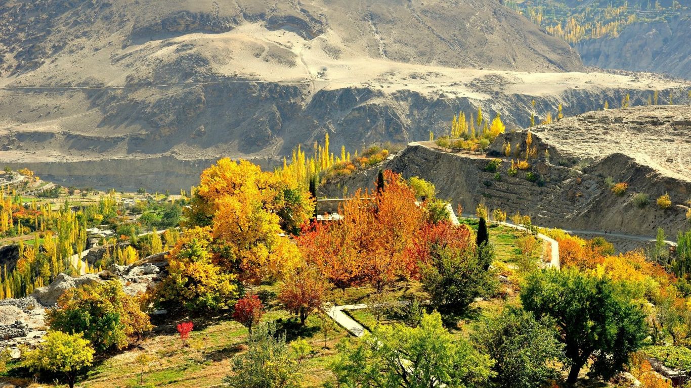
Jurm District is one of the 28 districts of Badakhshan province in northeastern Afghanistan. It is located about 3 hours from the provincial capital, Fayzabad. The district is known for its mountainous terrain and is home to the highest point in the Afghan Hindu Kush at 6,729 meters. The district capital is also called Jurm.
Key Information:
• Location: Badakhshan Province, northeastern Afghanistan.
• Capital: Jurm.
• Distance from Fayzabad: 3 hours.
• Highest Point: 6,729 meters (in the Afghan Hindu Kush).
• Population: Approximately 41,910 residents.
• Ethnic Groups: Largely Tajik speaking.
4. Kuran wa munjan district
Kuran wa Munjan is a remote, mountainous district in Badakhshan Province, Afghanistan. It's known for its lapis lazuli mines, particularly the famous Sar-e Sang deposit. The district's administrative center is the village of Kuran wa Munjan. Due to its high altitude, it experiences a subarctic climate with brief, cool summers and very cold, snowy winters.
Key Features:
• Location: Located in the Hindu Kush mountains, in the southwest corner of Badakhshan Province.
• Administrative Center: The village of Kuran wa Munjan.
• Lapis Lazuli: The district is renowned for its lapis lazuli mines, especially the Sar-e Sang mine.
• Climate: Subarctic climate with short, cool summers and long, cold, snowy winters.
• Development Challenges: Historically faced challenges related to development projects and basic infrastructure, like government buildings and markets.
• Border: Borders with other Afghan provinces and a small section of the international border with Pakistan.
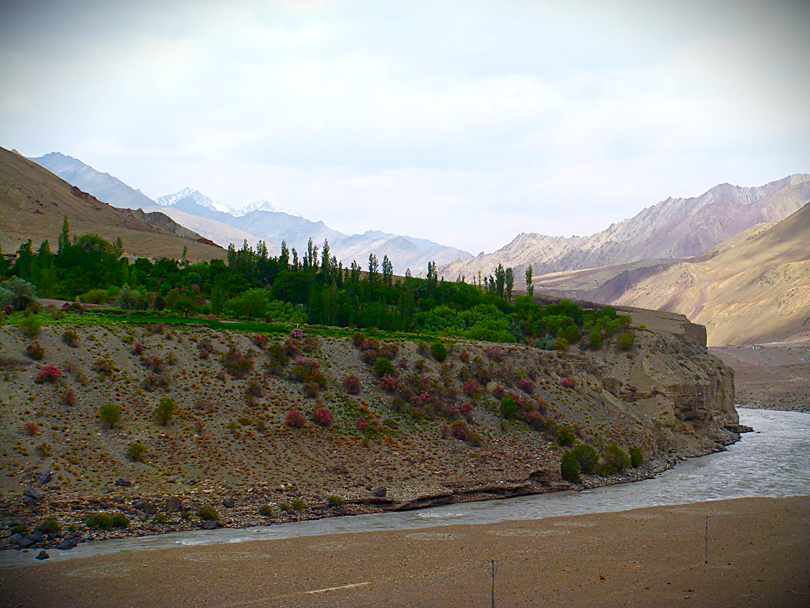
5. Zebak district
Zebak district is located in the Badakhshan province of Afghanistan. It is known for its scenic landscape, including the Topkhana Lakes.
The district capital, also called Zebak, is situated at the delta of the Sanglich river and is a gateway to Tajikistan and Pakistan.
The area is known for its unique culture, with inhabitants speaking the Sanglechi-Ishkashmi language.
Here's a more detailed breakdown:
Location:
Zebak is a district in the northeastern part of Badakhshan province, Afghanistan.
Geography:
The district is characterized by its mountainous terrain and valleys, including the Sanglich valley.
Climate:
Zebak has a humid continental climate, with mild, dry summers and cold, snowy winters.
Population:
It is home to an estimated 8,749 residents, with the majority living in the district center, Zebak.
Language:
The Sanglechi-Ishkashmi language, also known as Zebaki, is spoken in the district.
Culture:
The inhabitants of Zebak are known for their unique culture and traditions, including their language.
Tourism:
The Topkhana Lakes in Zebak attract both domestic and international tourists, particularly in the spring and summer, due to the area's scenery, weather, and the presence of spotted fish.
Topkhana Lake:
Topkhana Lakes, located in Zebak district of Badakhshan province, are a popular tourist destination known for their scenic beauty and unique landscape.
The lakes are situated near the border with Chitral, Pakistan, and the Sanglech village of Zebak. Visitors are drawn to the area by the calm and pleasant atmosphere, the presence of spotted fish, and the overall natural beauty of the area. The Topkhana Lake is reportedly 1,800 meters deep and 1,000 meters wide
6. Ishkashim district
Ishkashim district is located in the northeastern part of Badakhshan province, Afghanistan. It is a border district, sharing a border with Tajikistan along the Panj River.
The district is known for its capital, the town of Ishkashim, which is also a border crossing and a point of connection with the Tajik town of the same name. The district has a population of around 15,951 people.
Here's a more detailed look at Ishkashim district:
Location:
Ishkashim district is situated in the eastern part of Badakhshan province, Afghanistan, bordering Tajikistan along the Panj River.
Capital:
The town of Ishkashim serves as the district's capital and is a border town with a population of approximately 12,120.
Borders:
It shares a border with Ishkoshim district in Tajikistan across the Panj River. The Wakhan district lies to the east.
Population:
The district has an estimated population of 15,951, with a majority of ethnic Tajiks, followed by Pashtuns, Uzbeks, and others.
Language:
In addition to Dari and Pashto, the local language of Ishkashimi is also spoken in the district.
Geography:
The district lies in a fertile valley and is characterized by high mountains and deep river valleys.
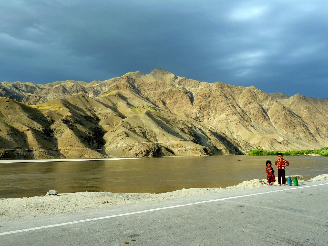
7. Wakhan district
The Wakhan District is a remote, mountainous region in northeastern Afghanistan, forming the Wakhan Corridor, a strategic panhandle bordering Tajikistan, Pakistan, and China.
It's a part of Badakhshan Province and is characterized by high altitude, rugged terrain, and limited access. The area is sparsely populated, with a majority of the population living in villages along the valleys of the Amu Darya and Ab-e Wakhan rivers.
Key Features of Wakhan District:
Location: Northeastern Afghanistan, forming the Wakhan Corridor.
Borders: Tajikistan (north), Pakistan (south), and China (east).
Geography: High-altitude mountainous region with valleys and high pastures.
Capital: Khandud.
Population: Sparsely populated, with Wakhi and Kyrgyz ethnic groups.
Ecology: Varies from desert conditions to steppe and meadows, with agricultural settlements in the valley bottoms.
National Park: Wakhan National Park, established in 2014, encompasses the entire district.
Historical Significance: An ancient corridor for trade and travel, playing a role in the Silk Road.
Geopolitical Importance: A buffer zone between major powers (formerly British and Russian Empires) and a potential trade route.
Accessibility: Limited road access, with a track from Ishkashim to Sarhad-e Broghil, and paths leading to the Wakhjir Pass into China.
Economy: Primarily based on agriculture, herding, and limited trade.
8. Baharak district:
Baharak is a district in Badakhshan Province, Afghanistan, located about 30 km southeast of Fayzabad. The district's capital is also named Baharak. The district is known for its diverse agro-ecological zones and varied farming systems.
Key Information about Baharak District:
Location: Situated in Badakhshan Province, approximately 30 km southeast of Fayzabad.
Capital: The town of Baharak serves as the district's capital.
Agriculture: Baharak features diverse agro-ecological zones, influencing farming practices and harvest seasons.
Security: The district has experienced security issues, including Taliban presence and control in some. areas
Water: Residents of Baharak have reported challenges accessing clean drinking water.Other
Names: The district is also known as Baharistan.
9. Shighnan district:
(also spelled Shughnan) district is located in the northeastern part of Badakhshan province, Afghanistan, and also has a corresponding district in Tajikistan. The Afghan Shighnan district's administrative center is called Qaleh Barpanjeh. The area is known for its mountainous terrain, including parts of the Hindu Kush and Pamir mountain ranges. It's also characterized by its unique cultural heritage, with a majority Tajik and Pamiri population speaking the Shughni language.
Key aspects of Shighnan district:
Geography:
Shighnan is a mountainous region, with much of it situated in the Hindu Kush and Pamir mountain ranges.
People and Language:
The district is primarily inhabited by Tajiks and Pamiris, who speak the Shughni language.
Administrative Center:
The administrative center of the Afghan Shighnan district is Qaleh Barpanjeh.
Climate:
Shighnan experiences a humid continental climate with cold, snowy winters and short, hot, and dry summers.
Historical Significance:
The region has a history of being a principality, with rulers claiming descent from Alexander the Great, and has been involved in territorial disputes throughout history.
Vulnerability:
The district is susceptible to natural disasters like avalanches, landslides, and floods, particularly due to its mountainous terrain and high-altitude villages.
Cultural Heritage:
Shighnan boasts a rich cultural heritage, with unique forms of music, poetry, and dance.
10. Ragh district:
Ragh, formerly a district in Badakhshan province, Afghanistan, is now divided into Raghistan, Yaawan, and Kohistan districts. Raghistan, the largest of these, is known for its mountainous terrain and historical gold mining activities.
The area is also recognized for its natural beauty and cultural significance.
Key Aspects of Ragh/Raghistan:
Historical Significance:
Ragh had a rich history, including gold mining operations that involved traditional methods of extracting gold from river sediments.
Geographical Features:
The region is mountainous with rivers, lakes, and diverse flora and fauna, offering scenic landscapes.
Current Status:
While Ragh was once a single district, it was divided into Raghistan, Yaawan, and Kohistan, with Raghistan being the most prominent.
Rivers:
Prominent rivers in the area include the Yawan, Rawinj, Siab Dasht, Du Dara, and Rahe Dara rivers.
Bordering Areas:
Raghistan borders Tajikistan and other districts of Badakhshan like Yaftal Bala, Yaftali Sufla, Khwahan, Kuf Ab, Maimay, Shighnan, Arghanj Khwa, and Shahri Buzurg.
Gold Mining:
Raghistan's gold mines are a source of income for the Taliban.
11. Khwahan district:
Khwahan is a district in Badakhshan province, northeastern Afghanistan. It borders Tajikistan to the northwest and shares a border with Shuro-obod district in Tajikistan. The district capital is also named Khwahan. The total population is approximately 27,000.
The district is mountainous, with the Hindu Kush and Pamir mountain ranges dominating the landscape. Khwahan is known for its humid continental climate, with September being the driest month and May the wettest.
Here's a more detailed breakdown:
Location: Khwahan District is situated in the northeastern part of Afghanistan, within Badakhshan province.
Borders: It is bordered by Raghistan district to the southwest, Kuf Ab district to the northeast, and Tajikistan (specifically Shuro-obod district) to the northwest.
Capital: The district's administrative center is the town of Khwahan.
Population: The population of Khwahan district is roughly 27,000.
Geography: It's a mountainous region, part of the larger Badakhshan province, which is characterized by the Hindu Kush and Pamir mountain ranges.
Climate: Khwahan experiences a humid continental climate, with significant rainfall variations throughout the year.
Villages: The district includes numerous villages, such as Guzun, where Kuh-e Kallat (Kallat peak) is located.
Historical Significance: Badakhshan province, including Khwahan, has a rich history, particularly known for its lapis lazuli mines, which were a valuable resource in ancient times.
12. Darwaz district:
Darwaz district, historically a single district in Badakhshan Province, Afghanistan, was divided in 2005 into Maimay, Darwazi Bala, and Shekay districts.
The original Darwaz district was part of the larger historic region of Darwaz, now split between Afghanistan and Tajikistan. The area is known for its rugged terrain, ranging from 1,300 to 3,350 meters in elevation.
Key Aspects:
Historical Significance:
Darwaz was once a semi-independent statelet ruled by a mir until 1878.
Geographic Location:
It borders Tajikistan to the north and is characterized by mountainous terrain, including the Pamir and Hindu Kush ranges.
Subdivision:
In 2005, Darwaz District was divided into three new districts: Maimay, Darwazi Bala, and Shekay.
Challenges:
The area faces accessibility challenges, particularly during certain times of the year, requiring alternative transportation methods like walking or animal transport.
Humanitarian Efforts:
Organizations like FOCUS, AKHS, and WFP have been involved in providing aid in the area, including shelter, food, and non-food items, with transportation often facilitated through Tajikistan.
Landslides:
Darwaz has experienced landslides, such as the one in Wachkan village in 2012, which caused fatalities and property damage.
13. Shahre buzurg district:
Shahri Buzurg is a district in Badakhshan province, Afghanistan, bordering Tajikistan. It's known for its mountainous terrain, proximity to the Tajikistan border, and a population of around 42,000.
The district faces challenges including inadequate infrastructure, particularly roads and healthcare facilities, and limited telecommunications.
Key Information about Shahri Buzurg:
• Location: Northwestern Badakhshan, bordering Tajikistan.
• Population: Approximately 42,000.
• Capital: The city of Shahr-e Bozorg.
• Geography: Mountainous and forested.
• Borders: International border with Tajikistan to the northwest and Takhar province to the southwest.
Challenges:
Infrastructure: Poor road conditions and lack of healthcare centers are major concerns.
Telecommunications: Limited access to reliable telecommunications and internet services.
Gold Mining: The district has gold mines, and the Taliban-led government has recently tendered some for mining.
Livelihoods: While gold mining is present, residents also rely on farming and other economic activities.
Local officials: are working to address the issues, including graveling the main road and working on other problems, such as clinic and telecommunication network, according to local officials.
Ethnicity: The population includes Tajiks.
Cultural Significance: The name "Shahri Buzurg" is Dari and means "The Great City”.
Eat
The best restaurants in Faizabad, Badakhshan include Kadbano Restaurant and Bam Dunya Restaurant. These two restaurants are very popular because of the quality of the food, the friendly atmosphere and the good service. Kadbano Restaurant is known for having a variety of domestic and foreign dishes and observing health standards, and Bam Dunya Restaurant is also known for hosting domestic and foreign guests.